AERIAL SURVEY & MAPPING
Save Time & Money
Get Real-Time Data with Drone Mapping
In today’s competitive real estate market, drone imaging is a must-have for creating standout listings. similarly, we are bringing that level of visual detail to your construction projects. Our aerial surveys provide a new angle by helping to show the same visual detail, from pre-construction planning to progress tracking and site inspections, from the ground up. Stay ahead of the curve, improve your workflow, and ensure successful project delivery with our drone-powered solutions.
Drone Mapping
Property Presentation
Land Parcel Showcase
Aerial mapping of land parcels offers versatile applications across various domains. For real estate, it provides compelling showcases for sales. In construction, it aids in planning and design. Beyond these, it supports elevation modeling and a range of other purposes. Pre-programmed flight paths, leveraging land grids, can be tailored to highlight properties of all sizes, from those under an acre to expansive tracts spanning hundreds of acres.
Business Maps
Transform how potential guests perceive your property with immersive aerial models. Witness the dynamic impact of showcasing pools, dining areas, and surrounding landscapes from a breathtaking new perspective, ultimately attracting a wider audience and enhancing the overall appeal of your unique accommodations.
3D Modeling
Harness the power of drone technology to create detailed 3D models of your residential or commercial construction site. From initial build to final inspection, these models offer unprecedented visualization capabilities. Go beyond traditional methods and leverage 3D modeling for comprehensive property and structure inspections, providing a level of insight previously unattainable.
Planned Communities
Introducing a new dimension in real estate development. Showcase your emerging communities through vibrant 2D and 3D models, providing residents and potential buyers with an unparalleled understanding of their future neighborhoods. With these cutting-edge visualizations, experience the fusion of architecture, landscape, and amenities in a way that brings the entire community to life.
Mapping Data
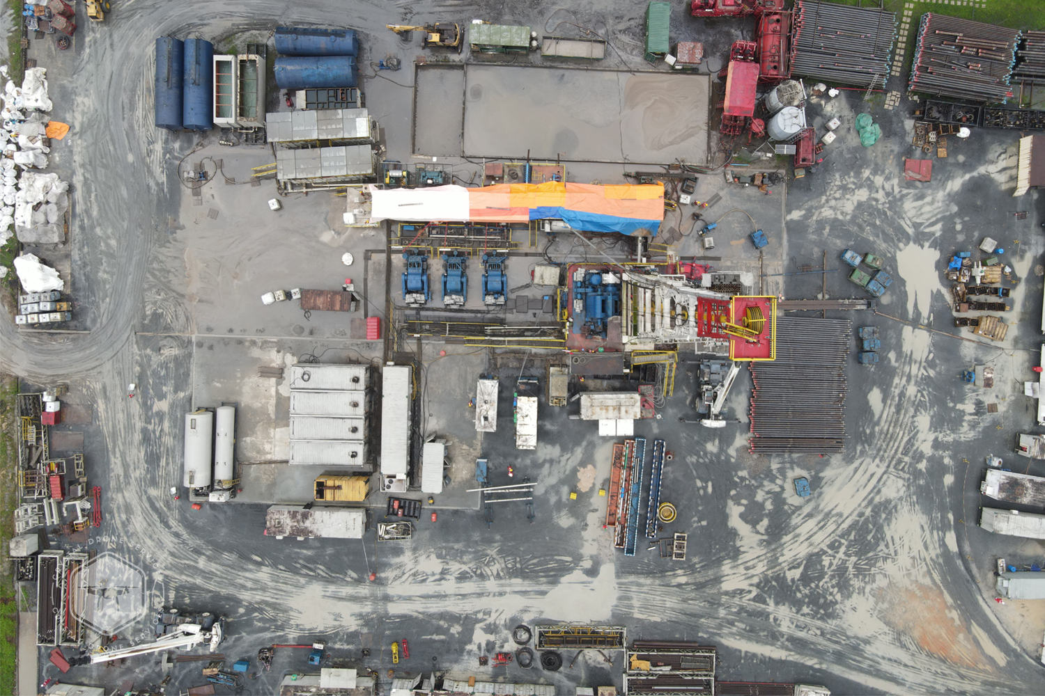
Aerial Survey Gallery
With Crystal Drones, capturing comprehensive aerial survey & mapping data is streamlined and insightful, enabling you to easily share detailed site analyses with stakeholders. We are committed to delivering unparalleled accuracy in aerial data acquisition and processing, leveraging the most sophisticated drone technologies available. Our advanced aerial solutions empower engineering firms, land developers, and government agencies to visualize and analyze landscapes with exceptional precision, facilitating informed decisions driven by reliable, high-resolution data.


Immersive Panoramas
360 Degree Panoramics
360-degree panoramas provide your website visitors with an exceptional bird’s-eye view of your project or business. For destination locations such as stadiums, bed and breakfasts, and tourist attractions, these immersive visuals offer online guests the unique opportunity to explore the area from an elevated perspective. A 360-degree panorama effectively addresses numerous inquiries regarding your business’s surroundings while showcasing the full scope of your offerings.
In this section, you will find a sample panorama featuring an aerial view for one of our esteemed clients. Users can easily zoom in and out, as well as click and drag to focus on various areas above and below. This interactive feature allows potential guests to fully appreciate the available camping sites and amenities. Furthermore, you can expand the panorama to full screen using the button located in the upper right corner, enhancing the visual experience and engagement for your audience.
Easily explore the panorama by clicking and dragging, or let the viewer guide you through the immersive 360-degree display. These images are compatible with desktops, laptops, tablets, and smartphones, allowing potential customers, buyers, or guests to interact with the 360-degree view on any device for a seamless experience.
Aerial Data Outputs
There are so many ways to share and use aerial data collected by Crystal Drone. Some are ideal for fun presentations and marketing materials, while others cater to the serious side of your business. The applications are wide open, and we’ll explore them on this page!
The types of outputs available will depend on your final vision. Job site images may fall into categories best suited for internal use. Other presentation formats may be intended for public consumption and can easily be embedded on your business website. Here’s a list of formats Crystal Drone can deliver:
- GeoTiffs – 2D
- Full-sized JPEGs – 2D
- DEM (Digital Elevation Model) – 2D
- NDVI – Outputs that allow for viewing vegetation health
- 3D Google Earth KMZ – 3D
- POINT CLOUD LAS – 3D
- OBJ – 3D
- MULTIPLE ADDITIONAL 3D OUTPUTS – PLY, FBX, DXF are just a few examples.
Your business needs will dictate the type of outputs Crystal Drone will need to provide. Most likely, you’ll want a few select formats, and the rest won’t be required. To determine the best fit, let’s talk! Contact us now to get the discussion started.
Key Deliverables
2D Models
Want a powerful aerial overview of your jobsite? A 2D model may be all you need to gain valuable insights. We can also create custom maps of your business or destination, offering a unique perspective beyond simple Google Maps.
3D Models
Struggling to get a clear picture of your jobsite's progress? A 3D model provides a comprehensive, multi-angle view, making it easier to identify and address potential delays.
360 Panoramics
Want a powerful aerial overview of your jobsite? A 2D model may be all you need to gain valuable insights. We can also create custom maps of your business or destination, offering a unique perspective beyond simple Google Maps.
Aerial Video Presentation
From time-lapse videos capturing job site progress to immersive fly-throughs showcasing your business, aerial photography and videography offer a wealth of possibilities. Present a unique, bird's-eye view of your business to customers and guests.
Trusted by
Our Clients


Crystal Drone Services
The Best in Cinematic
Aerial Photos & Videos
We offer nationwide drone photography and videography services, delivering professional consistency and reliability to elevate your brand.
We Follow Best Practices
We strictly adhere to industry standards & practices. This ensures our drone service operates efficiently, safely, and professionally, leading to better outcomes for your projects and a more successful business.
- Exceptional Customer Service
- Project Delivery On Time
- Compliance with Regulations
- Standard Gears & Equipments